Evertise
25 Aug 2023, 03:54 GMT+10
Getting started with Geographic Information System (GIS) software might seem like a daunting task for beginners, especially with the abundance of options and technical terminology. However, fear not! This comprehensive guide is tailored to newcomers in the world of GIS, providing a step-by-step roadmap to help you navigate through the intricacies of GIS software.
By the time you finish reading, you'll have a solid grasp of the basics and be well-equipped to embark on your GIS mapping services journey with confidence.
Whether you're a student, a professional in a different field, or simply curious about spatial data analysis, and this guide will pave the way for your successful initiation into the world of GIS software.
Before we dive into software selection, let's understand what GIS is. GIS is a technology that allows you to capture, analyze, and visualize geographic data on a map. It's used in various industries, from urban planning to environmental management, to make informed decisions based on spatial information.
GIS consists of several components, including spatial data, software, hardware, digital mapping, and people. The software is the tool that enables you to work with geographic data, and that's what we'll focus on in this guide.
Choosing the Right GIS Software
Start by defining your goals. Are you a student exploring GIS for educational purposes, or are you in a specific industry like forestry or real estate? Knowing your goals will help you narrow down the features you need in the software.
For beginners, a user-friendly interface is key. Look for software with an intuitive layout and simple navigation. This will make your learning curve smoother and your tasks more efficient.
You'll find both online (web-based) and desktop GIS software. Online software offers the advantage of accessibility from anywhere with an internet connection, while desktop software provides more advanced capabilities. Choose based on your preferences and needs.
There are both free and paid GIS software options available. If you're just starting and want to explore, free software like QGIS or ArcGIS Online can be great. Paid options like ArcGIS Desktop offer advanced features for professionals.
Getting Started with GIS Software
Once you've chosen your software, tap into learning resources. Many software providers offer tutorials, webinars, and forums where you can learn from experts and fellow beginners.
To get started, import your data into the software. This could be shapefiles, GPS data, satellite imagery, or even data from spreadsheets. Most software allows you to easily drag and drop data onto the map.
Take time to explore the software's interface. Familiarize yourself with tools like Zoom, pan, and basic analysis functions. Don't hesitate to experiment - learning by doing is a great way to grasp concepts.
Start with simple tasks like creating a basic map. Add layers, change symbols, and adjust colors. This will help you understand how to visualize data spatially.
Going Beyond the Basics
As you become more comfortable, explore spatial analysis. This involves conducting more complex operations like buffer zones, overlay analysis, and proximity analysis.
GIS isn't just about maps - it's about visualizing data in meaningful ways. Learn how to create graphs, charts, and other visuals to represent your spatial data effectively.
Apply your newfound skills to real-world projects. Whether it's creating a map for a school project or analyzing demographic data for a local community, practical application is the best way to learn.
FAQs (Frequently Asked Questions)
Do I need a background in geography to use GIS software?
No, a background in geography is not necessary. GIS software is designed for users from various fields and backgrounds.
What kind of computer specifications do I need for GIS software?
It depends on the software you choose, but generally, a modern computer with decent processing power and memory is sufficient.
Can I use GIS software for personal projects?
Absolutely! GIS software can be used for personal projects like planning a hiking route, visualizing travel data, or even mapping your favorite local spots.
Is online GIS software as powerful as desktop software?
Online GIS software has come a long way and offers many powerful features. However, for advanced analyses and larger projects, desktop software might provide more capabilities.
Can I collaborate with others using GIS software?
Yes, many GIS software options allow collaboration. You can share maps and data with colleagues or collaborate in real-time on online platforms.
Conclusion
Congratulations, you've taken the first steps into the exciting world of GIS software! Remember that learning GIS is a journey, and practice makes perfect. As you explore, you'll gain confidence and unlock the power of spatial data analysis.
Get a daily dose of Austin Globe news through our daily email, its complimentary and keeps you fully up to date with world and business news as well.
Publish news of your business, community or sports group, personnel appointments, major event and more by submitting a news release to Austin Globe.
More InformationNEW YORK, New York - Global stock indices closed with divergent performances on Tuesday, as investors weighed corporate earnings, central...
TORONTO, Canada: Canadian Prime Minister Mark Carney announced late on June 29 that trade negotiations with the U.S. have recommenced...
Vancouver, Canada: A high-stakes legal showdown is brewing in the world of athleisure. Lululemon, the Canadian brand known for its...
LONDON, U.K.: British oil giant Shell has denied reports that it is in talks to acquire rival oil company BP. The Wall Street Journal...
NEW YORK, New York - U.S. stock markets closed firmly in positive territory to start the week Monday, with the S&P 500 and Dow Jones...
WASHINGTON, D.C.: On Friday, President Donald Trump announced that he was halting trade discussions with Canada due to its decision...
MEXICO CITY, Mexico: Mexican President Claudia Sheinbaum said this week that her government is investigating possible environmental...
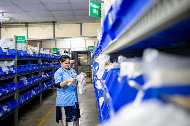
NEW YORK CITY, New York: Walmart is set to close a major Sam's Club fulfillment center in Fort Worth, Texas, as part of a shift in...
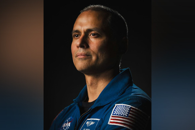
Washington DC [US], July 2 (ANI): NASA astronaut Anil Menon has been assigned his first mission to the International Space Station,...
Mumbai (Maharashtra) [India], June 30 (ANI): Anupam Kher's upcoming directorial 'Tanvi The Great' is creating a buzz in the entertainment...
Dallas [US], June 30 (ANI): The South African stars of Texas Super Kings (TSK) rose to the occasion as they secured a commanding 39-run...
Washington DC [US], June 30 (ANI): Former news anchor Lauren Sanchez officially tied the knot with Jeff Bezos in a star-studded Italian...